UAV Seagrass
The UAV mapping of coastal seagrass sites along the Pacific (West) coast of North America is being undertaken through a $1.3 million collaborative NSF grant. This project, co-led with Dr. Timothy Hawthorne represents one of the earliest attempts to employ UAV mapping in coastal management and seagrass conservation. This interdisciplinary project aims to assess the effects of three major stressors on coastal ecosystems—climate warming, altered biodiversity, and disease—on the local and regional health of seagrass. It integrates ecological, microbiological, computational, geospatial analysis, and UAV remote sensing to achieve its objectives.
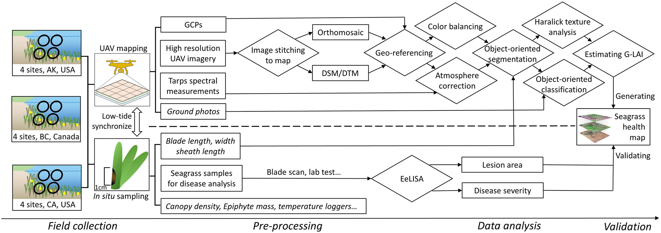
Wastingdisease causes healthy eelgrass lose greenness, which captured by low altitude UAV mapping and fine-scale image analysis for disease prevalence and severity. UAV’s temporal flexibility can better capture low tide or certain time frames and with larger coverage. Eelgrass in situ samples processed by EeLISA tool developed by CornellEEB and Computer science, AI-based eelgrass blades scan to valid the remotely sensed data. Statistical results suggest that Green Leaf Area Index (G-LAI) can explain up to 58% of eelgrass disease variation. By incorporating optical UAV mapping and high-resolution (<5cm) image processing, detection and monitoring of marine diseases are now more efficient and quick.
Several research institutes/universities are involved in interdisciplinary collaborations, including Smithsonian MarineGeo, Cornell University, UC Davis, University of Alaska Fairbanks, Oregon State University, San Diego State University, Hakai institute. Our collaborators include: Carla Gomes (Cornell), Deanna Beatty (UCD), Drew Harvell(Cornell), Emmett Duffy (SI), Fiona Tomas Nash (OSU), Ginny Eckert (UAF), John Stachowicz (UCD), Kevin Hovel (SDSU), Leah Harper (SI), Lillian Aoki (Cornell), Lia Domke (UAF), Margot Hessing-Lewis (Hakai), Olivia Graham (Cornell),
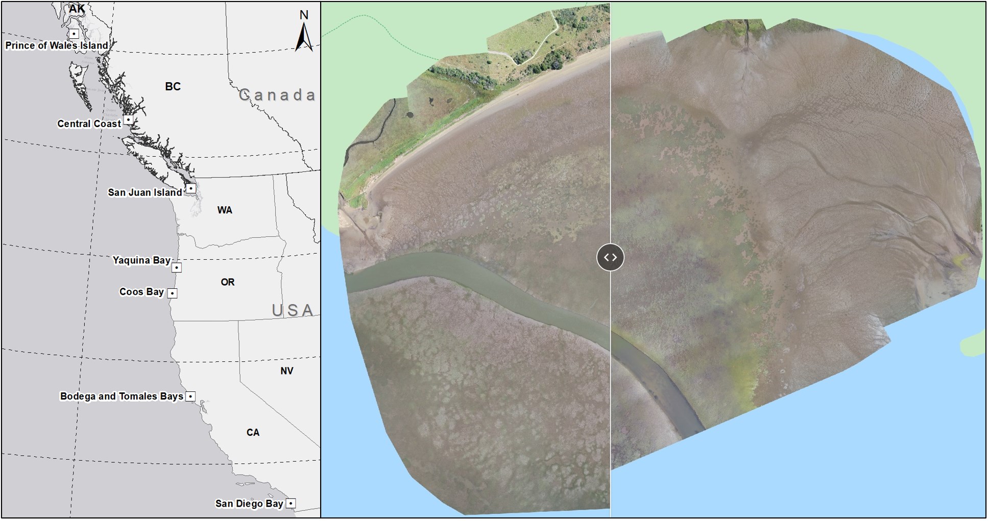
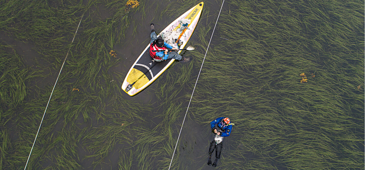
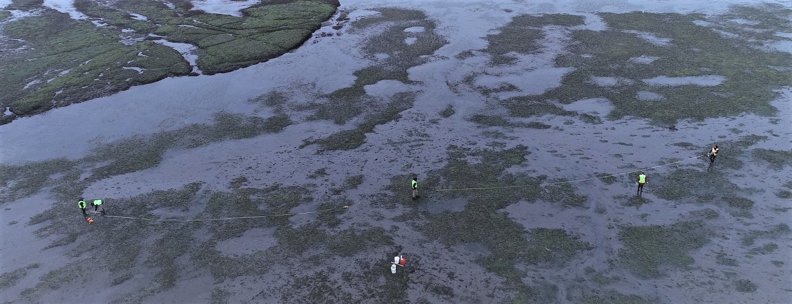
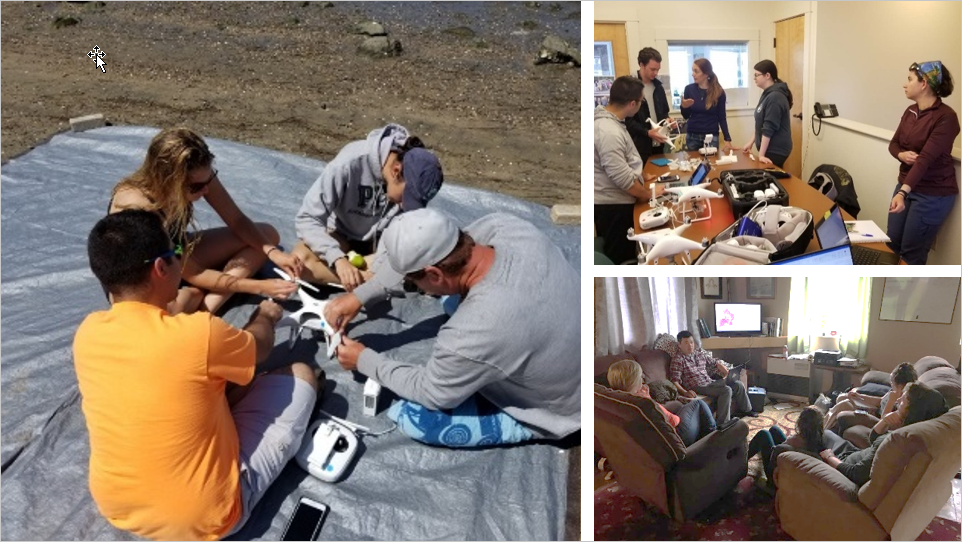
I have been leading a drone mapping team travel along the Pacific coast and collected over 10,000 drone remote sensing images along the U.S. Pacific coast. The drone remote sensing and field sampling sites include (From north to south): (1) six sites around Prince of Wales Island, Alaska; (2) five sites on the Central Coast of British Columbia (by Hakai team); (3) five sites in the San Juan Islands; (4) three sites in Yaquina Bay, Oregon; (5) two sites in Coos Bay, Oregon; (6) six sites in Bodega Bay and Tomales Bay, northern California; and (7) six sites in San Diego and Mission Bay in southern California.
I maintain an Open-access drone mapping course designed to teach the use of drones for collecting remote sensing data for coastal mapping and seagrass conservation. This training course was created for research partners and the broader community to learn how to fly drones and perform data processing using Geographic Information Science (GIS) methods. The course covers topics such as drone flight, coastal mapping principles, safety guidelines, preflight planning, FAA Part 107 examination, drone image stitching software, geographic fieldwork principles, and GIS-based drone image analysis..
For more info and viewing the data, please visit our Project Page and ArcGIS Story Map1 and Story Map2.
References:
- Yang, B., Hawthorne, T.L., Aoki, L.R., Beatty, D.S., Domke, L.K., Copeland, T., Eckert, G.L., Graham, O.J., Harper, L., Hessing-Lewis, M. Rappazzo, B., and Hovel, K.A., et al., (2023). Low-Altitude UAV Imaging Accurately Quantifies Eelgrass Wasting Disease from Alaska to California. Geophysical Research Letters DOI: 10.1029/2022GL101985
- Aoki, L.R., Yang,B., O.J. Graham, C. Gomes, B. Rappazzo, T.L. Hawthorne, J.E. Duffy, and D. Harvell. 2023. UAV high-resolution imaging and disease surveys combine to quantify climate-related decline in seagrass meadows. Oceanography 36(Supplement 1) DOI:10.5670/oceanog.2023.s1.12
- Graham, O.J., Stephens, T., Rappazzo, B., Klohmann, C., Dayal, S., Adamczyk, E.M., Olson, A., Hessing-Lewis, M., Eisenlord, M., Yang, B., Burge, C., Gomes, C., Harvell, D., (2023) Deeper habitats and cooler temperatures moderate a climate-driven seagrass disease. Phil. Trans. R. Soc. B 378: 20220016 DOI:10.1098/rstb.2022.0016
- Aoki, L.R., Rappazzo, B., Beatty, D.S., Domke, L.K., Eckert, G.L., Eisenlord, M.E., Graham, O.J., Harper, L., Hawthorne, T.L., Hessing-Lewis, M. and Hovel, K.A., Yang, B., et al., (2022). Disease surveillance by artificial intelligence links eelgrass wasting disease to ocean warming across latitudes. Limnology and Oceanography. DOI:10.1002/lno.12152
- Beatty DS, Aoki LR, … Yang, B. et al., (2022) Predictable Changes in Eelgrass Microbiomes with Increasing Wasting Disease Prevalence across 23° Latitude in the Northeastern Pacific. mSystems 0, e00224-22. DOI: 10.1128/msystems.00224-22
- Beatty D.S., Aoki L.R., Graham O.J., Yang B. (2021). The future is big—and small: remote sensing enables cross-scale comparisons of microbiome dynamics and ecological consequences. mSystems 6:e01106-21. DOI:10.1128/mSystems.01106-21
- Yang, B.; Hawthorne, T.L.; Hessing-Lewis, M.; Duffy, E.J.; Reshitnyk, L.Y.; Feinman, M.; Searson, H. (2020) Developing an Introductory UAV/Drone Mapping Training Program for Seagrass Monitoring and Research. Drones (Journal Cover Story), 4, 70. DOI:10.3390/drones4040070