All UAV projects

Urban Heat and Urban Transporation
We use thermal remote sensing and the urban heat budget to isolate and quantify the transportation impact on urban heat and climate change.
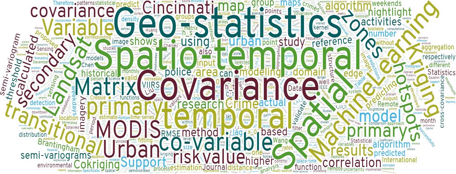
Crime Prediction and Spatial Statistics
We develop a novel geostatistical technique to integrate historical crime data and urban transitional zones identified from the VIIRS nightlight imagery for more accurate crime prediction.

ST-Cokriging and Image Fusion/Assimilation
We develop a spatio-temporal Cokriging (ST-Cokriging) method for assimilating multi-sensor remote sensing data that optimally determines parameters by accounting for spatio-temporal covariance. This method yields more reliable assimilation results than previous methods, effectively filling data gaps while providing quantitative uncertainty estimates.
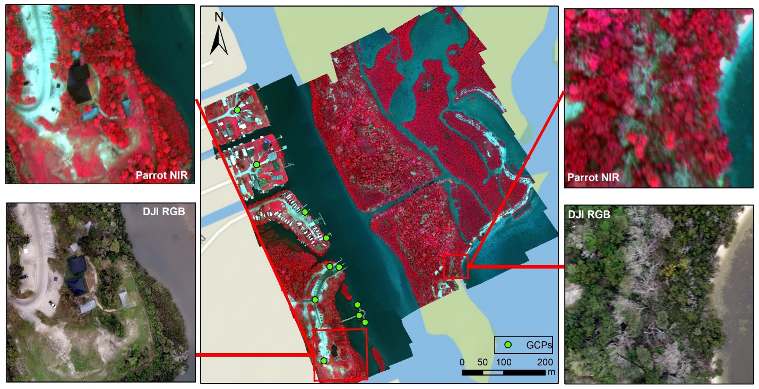
Drone mapping the Florida Coastal
Field trials of the multispectral UAV mapping were conducted over the Indian River Lagoon along the central Atlantic coast of Florida with Ground Control Points (GCPs), allowing for comparison to geo-referenced satellite and aerial imagery. Multi-spectral satellite imagery (Sentinel-2) was also obtained for the same region to map land cover. NDVI and object-oriented classification methods were employed to compare the mapping capabilities of UAVs and satellites.
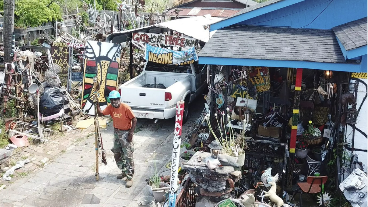
Mapping Joe minters Afirican American Village
The application of advanced technology to document and preserve an art installation demonstrated through the mapping and digital documentation of artist Joe Minter work. Minter, a found-object artist in Birmingham, has constructed a collection entitled African Village in America around his home in Birmingham, Alabama, which narrates his life story and cultural movement. Previously, visitors were required to view the monumental environment in person, but the digital rendering will make it accessible to a wider audience
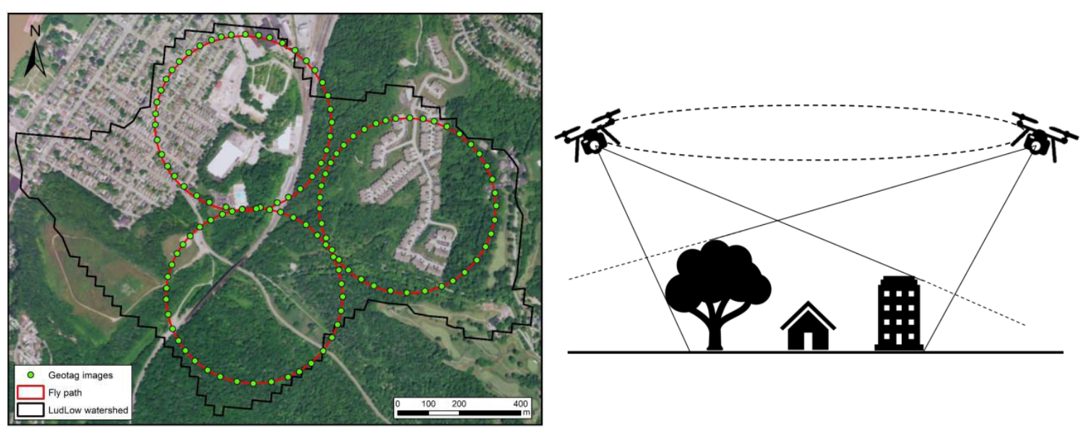
Drone for Hydological BML Management
This study aims to show the benefits of using higher resolution images in Best Management Practices (BMPs) analysis. A drone was used to collect better surface and elevation data, provided more accurate information about the study area, better watershed outlines, a more comprehensive list of suitable BMP locations, and a more reliable cost-effectiveness estimate than using low-resolution data. The study also determined how effective the chosen BMPs would be under future climate changes and identified the best BMPs for reducing urban runoff.
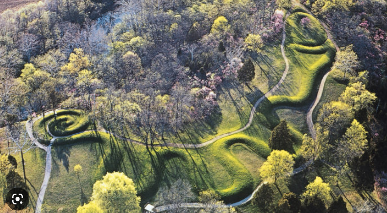
Drone Mapping the OH Serpent Mound
The Serpent Mound is an ancient and fascinating archaeological site located in Adams County, Ohio, USA. The mound is thought to have been built by the Adena culture (800 BCE – 100 CE) or the Fort Ancient culture (1000-1750 CE), though its exact origins are still debated among researchers. Drone mapping has been used to capture a bird’s-eye view of the Serpent Mound, which is believed to have served as a sacred space for various ceremonial and spiritual purposes, possibly linked to astronomical events such as the summer solstice, winter solstice, and equinoxes.